Official-source wildfire access and travel update · Sept. 5, 2026
Sept. 5 official wildfire check: BCWS rescinds three area restrictions, but live road and evacuation pages still matter
Source-card based on BC Wildfire Service, EmergencyInfoBC and DriveBC/Open511 captures made 2026-09-05T13:47:56.708164+00:00.
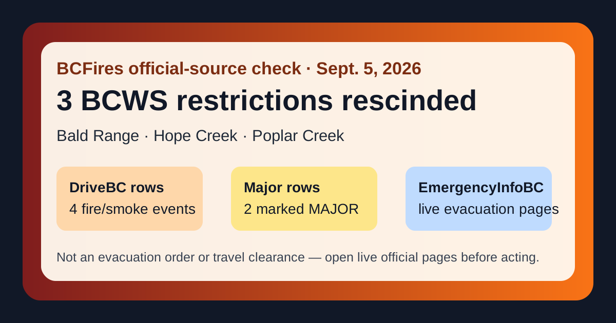
Bottom line: BC Wildfire Service posted three Sept. 4 access improvements: area restrictions were rescinded for the Bald Range, Hope Creek and Poplar Creek wildfire areas. That is good news, but it is not an all-clear. BCWS still describes affected fire areas as active worksites or burned areas with hazards, while DriveBC/Open511 and EmergencyInfoBC still carried wildfire-related road and evacuation-information pages in this morning's official-source check.
What BCWS says changed Sept. 4
The clearest publishable update today is access-related: BCWS says three area restrictions were rescinded at noon Pacific time on Sept. 4, 2026. The practical reader point is narrow: a rescinded area restriction may reopen access to the described restriction area, but it does not remove burned-area hazards, local authority evacuation instructions, road closures, fire bans or BCWS authority to order people out if conditions change.
| BCWS item | Posted | Official-source finding |
|---|---|---|
| Bald Range wildfire (K51490) | 2026-09-04T09:06:48 | Area Restriction Order rescinded effective Sept. 4, 2026 at noon PT; BCWS says the area is still an active job site and burned-area hazards may remain. Open BCWS notice |
| Hope Creek North wildfire (N71254) | 2026-09-04T11:18:45 | Area restriction rescinded effective Sept. 4, 2026 at noon PT; BCWS says the fire was estimated at 1,755 hectares and the area remains an active worksite. Open BCWS notice |
| Poplar Creek wildfire (N71253) | 2026-09-04T11:25:09 | Area restriction rescinded effective Sept. 4, 2026 at noon PT; BCWS says the fire was estimated at 664 hectares about 20 km northwest of Meadow Creek. Open BCWS notice |
EmergencyInfoBC still shows wildfire evacuation-information pages
EmergencyInfoBC's homepage is still the place to start for evacuation orders, alerts and authority pages. BCFires captured the homepage because the event API and the visible homepage can sort differently. The visible homepage listed wildfire evacuation-information cards including:
- Okanagan Indian Band evacuation information — issued by Okanagan Indian Band; homepage updated September 4, 2026. Open EmergencyInfoBC
- Squamish-Lillooet Regional District evacuation information — issued by Squamish-Lillooet Regional District; homepage updated September 3, 2026. Open EmergencyInfoBC
- Thompson-Nicola Regional District evacuation information — issued by Thompson-Nicola Regional District; homepage updated September 3, 2026. Open EmergencyInfoBC
- Cariboo Regional District evacuation information — issued by Cariboo Regional District; homepage updated September 3, 2026. Open EmergencyInfoBC
- Spuzzum First Nation evacuation information — issued by Spuzzum First Nation; homepage updated September 2, 2026. Open EmergencyInfoBC
- Regional District of Okanagan-Similkameen evacuation information — issued by Regional District of Okanagan-Similkameen; homepage updated September 2, 2026. Open EmergencyInfoBC
- Stswecem’c Xget’tem First Nation evacuation information — issued by Stswecem’c Xget’tem First Nation and Cariboo Regional District; homepage updated August 31, 2026. Open EmergencyInfoBC
- City of Revelstoke evacuation information — issued by City of Revelstoke; homepage updated August 31, 2026. Open EmergencyInfoBC
- Lytton First Nation evacuation information — issued by Lytton First Nation; homepage updated August 31, 2026. Open EmergencyInfoBC
- Coldwater Indian Band evacuation information — issued by Coldwater Indian Band; homepage updated August 29, 2026. Open EmergencyInfoBC
Those cards should be treated as gateways to the issuing local government or First Nation. They do not make this BCFires article an order or alert.
DriveBC/Open511 road rows still need live checking
DriveBC/Open511 was captured as an official travel snapshot. At capture time it contained 4 wildfire/fire/smoke-related rows, including 2 marked MAJOR. These road events can change after publication.
| Severity | Road | Updated | Official wording / link |
|---|---|---|---|
| MAJOR | Other Roads | 2026-09-04T13:30:53-07:00 | Silver Skagit Rd, in both directions. There is a wildfire between Silver Skagit Rd 6km mark and USA/Canada Border. Road closed. Closure point is approximately 6km south of Flood Hope Rd due to Provincial Parks closure caused by Hozomeen Mountain Wildfire. Silver Lake remains open. Ross Lake Campground and Skagit Valley Park closed. Next update time Mon Sep 7 at 12:00 PM PDT. Last updated Fri Sep 4 at 1:30 PM PDT. (DBC-93773) Open Open511 event |
| MAJOR | Other Roads | 2026-09-04T10:37:17-07:00 | Princeton Summerland Rd. There is a wildfire between Trout Creek Main and Summerland 45 km north of Princeton. Road closed. Watch for traffic control. Alternate Routes: Highway 5A and Highway 3. Next update time Tue Sep 8 at 10:00 AM PDT. Last updated Fri Sep 4 at 10:37 AM PDT. (DBC-93947) Open Open511 event |
| MINOR | Westside Rd | 2026-09-02T11:11:42-07:00 | Westside Rd, in both directions. There is a wildfire between Komasket Rd and Simla Rd for 8.1 km (48 to 56 km east of West Kelowna). Westside Rd is open. No stopping between Irish Creek Rd and Komasket Rd. Next update time Fri Sep 18 at 12:00 PM PDT. Last updated Wed Sep 2 at 11:11 AM PDT. (DBC-93854) Open Open511 event |
| MINOR | Highway 5 | 2026-08-25T09:58:57-07:00 | Construction work from Highway 5, At Exit 250 to Larson Hill to At Exit 256 to Coldwater Road. Starting Tue Aug 25. Left lane closed in both directions. Expect delays. Last update: August 25th, 2026 at 9:58am PDT. 24/7 construction. Please obey signage, slow down and watch for roadside workers. Expect delays and higher traffic volume due to Highway 1/Highway 3 wildfire activity. Open Open511 event |
What readers should do before moving through affected areas
- Open EmergencyInfoBC and the issuing local or First Nation authority page for current evacuation orders and alerts.
- Open DriveBC before travelling; do not rely on screenshots or older social posts.
- Open the BC Wildfire Service latest posts and the BCWS bans/restrictions pages for the relevant fire centre.
- Report new smoke from green, unburned fuel or outside a known fire perimeter to BCWS using 1-800-663-5555 or *5555 on a cellphone.
Source package
- Source note
- Claim table
- Source summary JSON
- DriveBC/Open511 filtered JSON
- BCWS latest-posts capture
- EmergencyInfoBC event API capture
BCFires is independent and not an official emergency service. For urgent instructions, use official emergency channels.