Daily official-source check · August 21, 2026
August 21 official wildfire travel check: Highway 1 closure, Okanagan routes and evacuation links still need live checks
This morning’s BCFires snapshot is travel-and-safety focused: DriveBC still listed major wildfire-related closures or restrictions, EmergencyInfoBC still had active evacuation/action pages, and the BC Wildfire Service blog feed did not show a newer bulletin than its Aug. 19 Prince George Fire Centre burn-ban post at capture time.
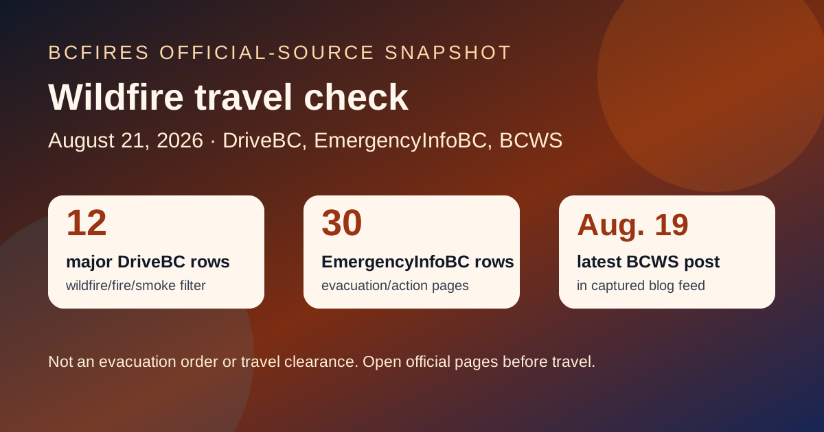
What the official sources showed at capture time
- DriveBC/Open511: 22 wildfire/fire/smoke rows were found in the public event feed, including 12 marked major by DriveBC.
- EmergencyInfoBC: 30 event rows were captured in the EmergencyInfoBC public event API; the latest modified timestamp in the captured rows was 2026-08-20T14:46:05.
- BCWS latest posts: the latest captured BC Wildfire Service blog post was 2026-08-19T14:13:24: Category 2 and 3 open fire to be prohibited for parts of the Prince George Fire Centre.
Selected DriveBC wildfire/fire/smoke road rows
Open the live DriveBC event before travelling. The table below preserves selected rows from the captured Open511 feed; it is not a replacement for live traffic control, evacuation orders or local authority instructions.
| Road / route | DriveBC severity | Updated in feed | Captured official wording |
|---|---|---|---|
| Highway 1 | MAJOR | 2026-08-20T16:14:02-07:00 | Highway 1 (TransCanada Highway), in both directions. There is a wildfire between Toll Rd and Aspen Rd for 38.8 km (Yale to 28 km south of Jackass Mountain Summit). Road closed. Highway 1 closed due to wildfire burning north of Hells Gate in close proximity to the highway. Southbound closure south of Boston Bar. Northbound closur… |
| Highway 97 | MAJOR | 2026-08-20T15:26:13-07:00 | Wildfire from Highway 97, In Spallumcheen and At Highway 97 and Old Kamloops Road to At Salmon River Road. Road open. Watch for traffic control. Last update: August 20th, 2026 at 3:26pm PDT. Next update: August 21st, 2026 at 3:00pm PDT. No stopping between Head of the Lake Rd and Grandview Flats Rd. |
| Westside Rd | MAJOR | 2026-08-20T15:24:41-07:00 | Westside Rd, in both directions. There is a wildfire between Komasket Rd and Simla Rd for 8.1 km (48 to 56 km east of West Kelowna). Westside Rd is open. No stopping between Irish Creek Rd and Komasket Rd. Use caution. Avoid non-essential travel. Local traffic only. Next update time Fri Aug 21 at 3:00 PM PDT. Last updated Thu Au… |
| Other Roads | MAJOR | 2026-08-20T12:22:33-07:00 | Princeton Summerland Rd. There is a wildfire between Trout Creek Main and Summerland 45 km north of Princeton. Road closed. Watch for traffic control. Alternate Routes - HWY 5A & HWY 3. Next update time Fri Aug 21 at 10:00 AM PDT. Last updated Thu Aug 20 at 12:22 PM PDT. (DBC-93947) |
| Big Bar Reaction Ferry | MAJOR | 2026-08-19T20:19:39-07:00 | Big Bar Reaction Ferry. There is a wildfire at Big Bar Reaction Ferry (Big Bar Reaction Ferry). Ferry route closed. Next update time Fri Aug 21 at 12:00 PM PDT. Last updated Wed Aug 19 at 8:19 PM PDT. (DBC-93766) |
| Other Roads | MAJOR | 2026-08-19T20:19:20-07:00 | Silver Skagit Rd, in both directions. There is a wildfire between Silver Skagit Rd 6km mark and USA/Canada Border. Road closed. Closure point is approximately 6km south of Flood Hope Rd due to Provincial Parks closure caused by Hozomeen Mountain Wildfire. Silver Lake remains open. Ross Lake Campground and Skagit Valley Park clos… |
| Highway 3 | MAJOR | 2026-08-19T17:43:18-07:00 | Wildfire from Highway 3, in Manning Park to 8km west of Allison Pass. Speed Limit restriction: 80km/h. Last update: August 19th, 2026 at 5:43pm PDT. Next update: August 28th, 2026 at 5:00pm PDT. Reduced to one lane in each direction in the westbound lanes. Follow traffic control signage. No stopping in wildfire zones. |
| Highway 97 | MAJOR | 2026-08-18T07:22:39-07:00 | Wildfire from Highway 97, In Peachland and 500m north of Hardy St to At Pyramid Picnic Area (Kickininee Provincial Park). Last update: August 18th, 2026 at 7:22am PDT. Next update: August 21st, 2026 at 12:00pm PDT. Highway 97 OPEN. No exiting into evacuation order areas. Watch for workers. Evacuation info via Emergency Info BC. |
| Highway 3 | MINOR | 2026-08-20T16:23:48-07:00 | Highway 3 (Crowsnest Highway). Limited visibility with smoke between First Avalanche Gate and Sunday Summit for 78.6 km (17 km east of Hope to 32 km west of Princeton). Last updated Thu Aug 20 at 4:23 PM PDT. (DBCRCON-250667) |
| Highway 95 | MINOR | 2026-08-20T06:28:17-07:00 | Limited visibility with smoke between BC/US Border (Kingsgate) and Sinclair Creek Loop Road (Curzon Junction). Last update: August 20th, 2026 at 6:28am MST. Next update: August 21st, 2026 at 6:57am MST. |
EmergencyInfoBC pages to re-check
EmergencyInfoBC aggregates provincial emergency links and local-authority evacuation/action pages. Readers should still open the relevant First Nation, municipality or regional district page for the binding local order or alert.
- Cayoose Creek Indian Band evacuation information modified 2026-08-15T11:38:07
- Cook’s Ferry Indian Band evacuation information modified 2026-08-11T13:53:18
- Lower Similkameen Indian Band evacuation information modified 2026-08-17T17:13:54
- City of Revelstoke evacuation information modified 2026-08-15T15:54:34
- Snpink’tn Indian Band evacuation information modified 2026-08-15T13:26:00
- Nooaitch Indian Band evacuation information modified 2026-08-11T13:57:43
- Province of British Columbia modified 2026-08-20T14:46:05
- Regional District of Okanagan-Similkameen evacuation information modified 2026-08-16T18:09:32
BCWS latest-post context
At capture time, the latest BCWS blog item in the public WordPress feed was still the Prince George Fire Centre Category 2 and 3 open-fire prohibition post. That matters because today’s update is mainly a travel/evacuation-link check, not a new BCWS fire-boundary or cause bulletin.
- 2026-08-19T14:13:24 — Category 2 and 3 open fire to be prohibited for parts of the Prince George Fire Centre
- 2026-08-17T10:38:34 — Area restriction to be rescinded for Mount Rollins area
- 2026-08-17T10:03:51 — Area restriction rescinded for the Calamity Creek area
- 2026-08-14T10:10:50 — Area restriction implemented in vicinity of Ainslie Creek wildfire
- 2026-08-10T17:44:13 — Area restriction in effect for Mount Rollins area
Source package
- Source note
- Source summary JSON
- Filtered DriveBC/Open511 wildfire-event JSON
- DriveBC road summary
- EmergencyInfoBC event summary
- BCWS latest-posts summary
Captured 2026-08-21T06:47:13-07:00. BCFires is independent and not an official emergency service.