Facebook source-context update · road detour + wildfire science
Two B.C. wildfire updates: Hwy 97 detour via 201 FSR and NASA pyroCb research flight
Updated August 9, 2026 · Independent source-context post
Update 1: DriveBC screenshot for Hwy 97 / Summerland fire detour
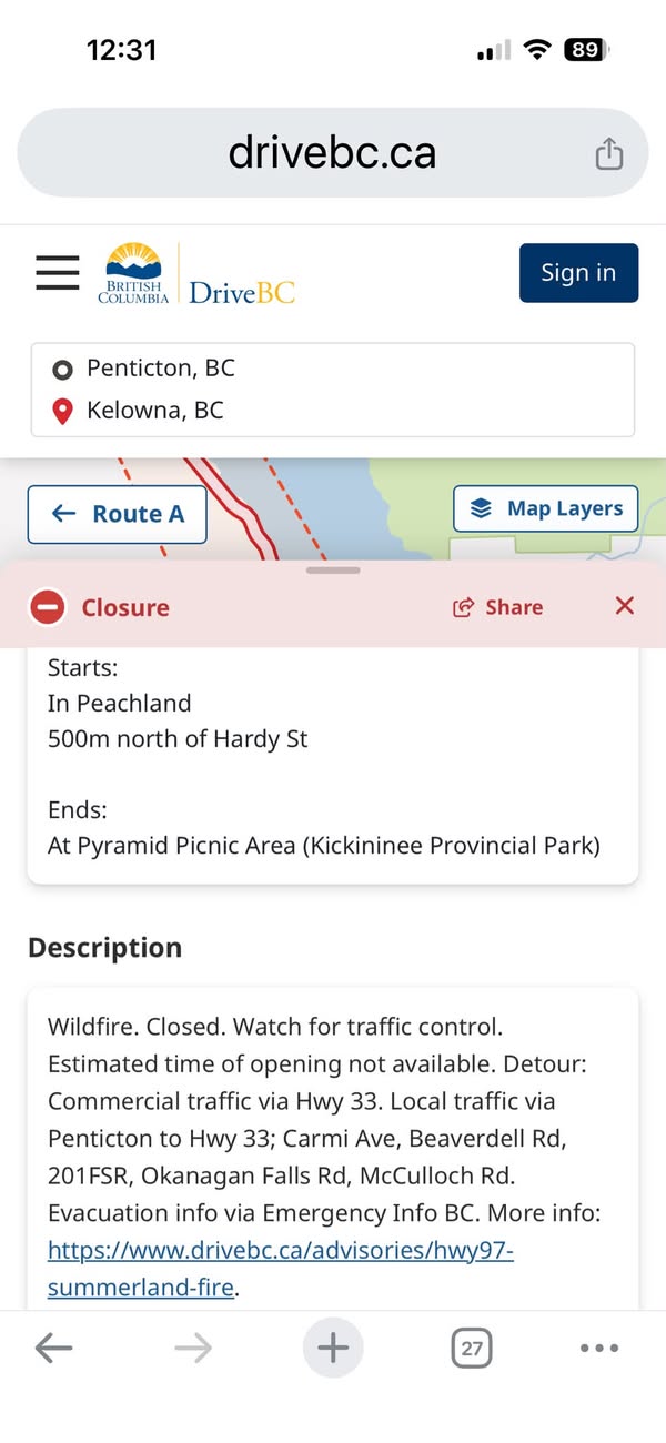
The Beaverdell-area Facebook update points to stress and uncertainty around the 201 FSR detour. The attached DriveBC screenshot shows a Highway 97/Summerland fire closure and a local detour route using Carmi Ave, Beaverdell Rd, 201 FSR, Okanagan Falls Rd and McCulloch Rd, while commercial traffic is directed via Highway 33.
The official DriveBC advisory says the Highway 97 Summerland fire detour via Forest Service Road 201 and Highway 33 is about 107 to 121 km and adds a key note: the FSR route is intended for passenger vehicles only. Drivers should fuel up, bring supplies, plan for daylight and expect conditions to change.
Update 2: NASA ER-2 / INSPYRE pyrocumulonimbus research image
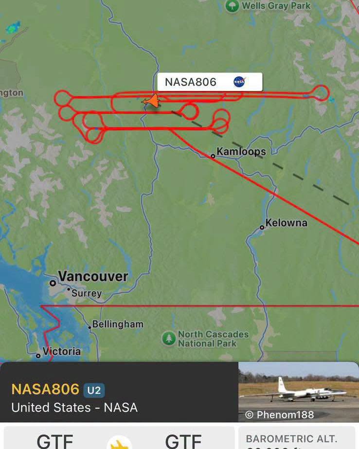
The second Facebook update says NASA has been flying above southern B.C. using a modified U-2 aircraft known as an ER-2, collecting data for the INjected Smoke and PYRocumulonimbus Experiment, or INSPYRE.
NASA/ESPO’s INSPYRE page describes the mission as an effort to constrain the role of pyrocumulonimbus clouds in the earth system and characterize physical links to extreme wildfire behaviour. NASA’s ER-2 page describes the aircraft as a high-altitude sensor platform operating up to about 70,000 feet for earth-resource, atmospheric and oceanic data collection.
Evidence table
| Point | Status | BCFires note |
|---|---|---|
| DriveBC has a Hwy 97 / Summerland fire advisory with a 201 FSR detour. | Officially supported | DriveBC advisory checked directly. It says the FSR route is for passenger vehicles only. |
| The Facebook DriveBC image shows 201 FSR / Carmi / Beaverdell / Okanagan Falls / McCulloch detour text. | Image-supported | Useful screenshot, but current road status must be checked on DriveBC. |
| NASA has an INSPYRE mission studying pyrocumulonimbus links to extreme wildfire behaviour. | Officially supported | NASA/ESPO and NASA Air INSPYRE project pages checked. |
| The NASA806 aircraft track proves a cause of the fire or a conspiracy. | Not proven | The checked official context supports data collection and research, not causation or a weapon claim. |
Official links to check now
- DriveBC Hwy 97 Summerland fire advisory
- EmergencyInfoBC wildfire page
- BC Wildfire Dashboard
- NASA/ESPO INSPYRE mission page
- NASA ER-2 aircraft page
Emergency reminder: If life or property is at immediate risk, call 911. To report a wildfire, call 1-800-663-5555 or *5555 on a cellphone.