Official-source daily check · Published August 18, 2026
August 18 official wildfire check: two BCWS area restrictions rescinded, but road and evacuation checks remain
BCFires daily official-source wildfire check for August 18, 2026: BC Wildfire Service rescinded Mount Rollins and Calamity Creek area restrictions, while EmergencyInfoBC and DriveBC still require live checks before travel or return.
Short verdict
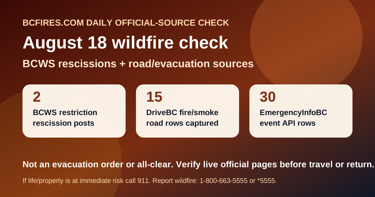
Official sources support a dated daily source card. BC Wildfire Service posted August 17 rescission notices for the Mount Rollins and Calamity Creek area restrictions, while warning that affected wildfire areas can still contain unstable trees, ash pits and active-worksite hazards. EmergencyInfoBC still exposed 30 event API rows and 44 wildfire/evacuation/action links in the homepage capture. DriveBC/Open511 showed 15 wildfire/fire/smoke road events, including 12 marked major.
This article does not create a new evacuation order, alert, road detour, safe-return clearance, fire boundary or cause determination. It is a source snapshot pointing readers to the live agency pages before travel, return-home decisions or social sharing.
BCWS: two area restrictions rescinded, not a blanket all-clear
- Area restriction to be rescinded for Mount Rollins area — posted 2026-08-17. CASTLEGAR – The BC Wildfire Service continues to respond to the Mount Rollins wildfire (N51257). This wildfire is estimated to be 236 hectares and is located in the Mount Rollins area, 11 km southeast of Needles. Fire behaviour and activity for the Mount Rollins wildfire (N51257) has decreased and firefighting personne
- Area restriction rescinded for the Calamity Creek area — posted 2026-08-17. CASTLEGAR – The BC Wildfire Service continues to respond to the Calamity Creek wildfire (N11036). This wildfire is estimated to be 181 hectares and is located in the Calamity Creek area, 39 km northwest of the City of Kimberley. Fire behaviour and activity for the Calamity Creek wildfire (N11036) has decreased and fire
- Area restriction implemented in vicinity of Ainslie Creek wildfire — posted 2026-08-14. HOPE – The BC Wildfire Service is implementing an Area Restriction Order within the vicinity of the Ainslie Creek wildfire (V10755), located east of the Fraser River near Boston Bar. This Order takes effect at 12 p.m. (noon) PDT on Friday, August 14, 2026, and will remain in place until 12 p.m. (noon) PDT on August … C
- Area restriction in effect for Mount Rollins area — posted 2026-08-10. CASTLEGAR – The BC Wildfire Service continues to respond to the N51257 wildfire in the Mount Rollins area. This wildfire is estimated to be 236 hectares and is suspected to be lightning-caused. In the interest of public safety, this area restriction is effective immediately and remains in place until the earlier of 12:
- Off-road vehicles to be prohibited in the Kamloops Fire Centre — posted 2026-08-10. KAMLOOPS – Effective at 12 p.m. (noon) Pacific Daylight Time (PDT) on August 10, 2026, off-road vehicles (ORV) will be prohibited on Crown land throughout the Kamloops Fire Centre. Given the scope and scale of fires currently burning in B.C., and the elevated danger ratings in many southern regions of the province, thi
For both Mount Rollins and Calamity Creek, the latest BCWS wording says fire behaviour and activity decreased enough that personnel no longer need the area restriction. The safety caveat remains important: BCWS says fire-damaged trees may be unstable, ash pits can remain hot, smoke may still be seen, and officials still have authority to order people to leave an area when needed.
EmergencyInfoBC: evacuation/action pages remain the first stop
EmergencyInfoBC pages can change quickly. The current capture included these recent event-page titles:
- Cayoose Creek Indian Band evacuation information — modified 2026-08-15T11:38
- Cook’s Ferry Indian Band evacuation information — modified 2026-08-11T13:53
- Lower Similkameen Indian Band evacuation information — modified 2026-08-17T17:13
- City of Revelstoke evacuation information — modified 2026-08-15T15:54
- Snpink’tn Indian Band evacuation information — modified 2026-08-15T13:26
- Nooaitch Indian Band evacuation information — modified 2026-08-11T13:57
- Province of British Columbia — modified 2026-08-10T11:22
- Regional District of Okanagan-Similkameen evacuation information — modified 2026-08-16T18:09
Use the live EmergencyInfoBC page and the affected local government, regional district or First Nation emergency page before acting on a screenshot or second-hand post.
DriveBC/Open511: wildfire, fire and smoke road rows still need live checking
The table below is a dated snapshot of selected DriveBC/Open511 rows captured by BCFires. Conditions can change quickly; DriveBC remains the live source for closures, traffic-control instructions, alternate routes and next-update times.
| Road / first line | DriveBC updated | Severity | Official wording captured | Live source |
|---|---|---|---|---|
| Big Bar Rd, in both directions | 2026-08-15T11:57:51-07:00 | MAJOR | Big Bar Rd, in both directions. There is a wildfire between Little Big Bar Lake Rd and The Big Bar Ferry. Road closed. Road closed to all traffic except emergency vehicles. Next update time Fri Aug 21 at 12:00 PM PDT. Last updated Sat Aug 15 at 11:57 AM PDT. (DBC-93680) | DriveBC |
| Highway 1 (TransCanada Highway), in both directions | 2026-08-17T16:04:48-07:00 | MAJOR | Highway 1 (TransCanada Highway), in both directions. There is a wildfire between Toll Rd and Aspen Rd for 38.8 km (Yale to 28 km south of Jackass Mountain Summit). Road closed. Highway 1 closed due to wildfire burning north of Hells Gate in close proximity to the highway. Southbound closure south of Boston Bar. Northbound closur | DriveBC |
| Jesmond Rd, in both directions | 2026-08-15T11:58:09-07:00 | MAJOR | Jesmond Rd, in both directions. There is a wildfire between Big Bar Rd and Pavilion Clinton Rd. Road closed. Road closed to all traffic except emergency vehicles. Next update time Fri Aug 21 at 12:00 PM PDT. Last updated Sat Aug 15 at 11:58 AM PDT. (DBC-93780) | DriveBC |
| Meadow Lake Rd, in both directions | 2026-08-15T11:55:53-07:00 | MAJOR | Meadow Lake Rd, in both directions. There is a wildfire between Dog Creek Rd and Gang Ranch Rd. Road closed. Road closed to all traffic except emergency vehicles. Next update time Fri Aug 21 at 12:00 PM PDT. Last updated Sat Aug 15 at 11:55 AM PDT. (DBC-93781) | DriveBC |
| Princeton Summerland Rd | 2026-08-14T11:01:39-07:00 | MAJOR | Princeton Summerland Rd. There is a wildfire between Trout Creek Main and Summerland 45 km north of Princeton. Road closed. Watch for traffic control. Alternate Routes - HWY 5A & HWY 3. Next update time Tue Aug 18 at 12:00 PM PDT. Last updated Fri Aug 14 at 11:01 AM PDT. (DBC-93947) | DriveBC |
| Silver Skagit Rd, in both directions | 2026-08-13T16:22:18-07:00 | MAJOR | Silver Skagit Rd, in both directions. There is a wildfire between Silver Skagit Rd 6km mark and USA/Canada Border. Road closed. Closure point is approximately 6km south of Flood Hope Rd due to Provincial Parks closure caused by Hozomeen Mountain Wildfire. Silver Lake remains open. Ross Lake Campground and Skagit Valley Park clos | DriveBC |
| Big Bar Reaction Ferry | 2026-08-17T11:35:52-07:00 | MAJOR | Big Bar Reaction Ferry. There is a wildfire at Big Bar Reaction Ferry (Big Bar Reaction Ferry). Ferry route closed. Next update time Tue Aug 18 at 12:00 PM PDT. Last updated Mon Aug 17 at 11:35 AM PDT. (DBC-93766) | DriveBC |
Source package
- Source note
- Source summary JSON
- DriveBC/Open511 filtered wildfire events JSON
- EmergencyInfoBC summary
- BCWS latest-post summary
BCFires.com is independent and not an official emergency-alert service. This page preserves a dated source trail and points readers back to official live pages.