Official-source wildfire check · August 23, 2026
August 23 official wildfire check: B.C. state of emergency extended to Aug. 29
EmergencyInfoBC’s current provincial emergency page says B.C. has extended the State of Provincial Emergency until Saturday, Aug. 29, 2026 because of regional wildfires. Treat that as a prompt to check the live local order, road and wildfire pages before travelling, returning home or sharing screenshots.
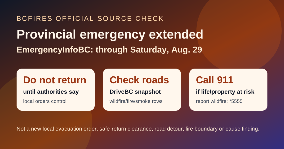
Emergency wording: If life or property is at immediate risk, call 911. To report a wildfire, call 1-800-663-5555 or *5555 on a cellphone.
Verdict Official provincial-emergency status confirmed; local instructions still need live checking.
EmergencyInfoBC says the province-wide emergency status has been extended to Aug. 29 due to regional wildfires. That status is not the same thing as a new evacuation order for every community, and it is not a safe-return clearance for evacuated areas. Local governments, First Nations, EmergencyInfoBC event pages, DriveBC and BC Wildfire Service remain the sources to check for the exact place you are in or travelling through.
What the official page says
- EmergencyInfoBC lists the event as Province of British Columbia and shows it updated on August 21, 2026 at 2:00 p.m.
- The current-situation text says the Province of British Columbia has extended the State of Provincial Emergency until Saturday, Aug. 29, 2026 due to regional wildfires.
- Recommended actions include leaving immediately if under an Evacuation Order, following local emergency officials and RCMP, registering with Emergency Support Services if evacuated, not returning until authorities say it is safe, and monitoring official updates.
- This BCFires article is not a fire-boundary map, road detour, cause/arson finding or local evacuation notice.
Live pages to check before acting
- EmergencyInfoBC provincial emergency page
- EmergencyInfoBC current emergencies and the local/First Nation authority page for your area
- DriveBC for road closures, smoke-visibility warnings and wildfire-related restrictions
- BC Wildfire Service for fire status, bans and restrictions
EmergencyInfoBC event snapshot
In the captured API snapshot, BCFires found 30 relevant wildfire/evacuation/provincial-emergency rows among 30 current EmergencyInfoBC event rows. Check the live page before relying on any date or local status.
- Cayoose Creek Indian Band evacuation information — modified 2026-08-15T11:38:07
- Cook’s Ferry Indian Band evacuation information — modified 2026-08-11T13:53:18
- Lower Similkameen Indian Band evacuation information — modified 2026-08-17T17:13:54
- City of Revelstoke evacuation information — modified 2026-08-15T15:54:34
- Snpink’tn Indian Band evacuation information — modified 2026-08-15T13:26:00
- Nooaitch Indian Band evacuation information — modified 2026-08-11T13:57:43
- Province of British Columbia — modified 2026-08-21T15:37:54
- Regional District of Okanagan-Similkameen evacuation information — modified 2026-08-21T15:14:08
DriveBC wildfire/fire/smoke road snapshot
DriveBC’s Open511 feed showed 16 wildfire/fire/smoke-related rows in this capture, including 12 marked MAJOR. Road events can change quickly and are not evacuation orders.
| Severity | Visible official wording | Updated |
|---|---|---|
| MAJOR | Wildfire from Highway 3, in Manning Park to 8km west of Allison Pass. Speed Limit restriction: 80km/h. Last update: August 19th, 2026 at 5:43pm PDT. Next update: August 28th, 2026 at 5:00pm PDT. Reduced to one lane in each direction in the westbound lanes. Follow traffic control signage. No stopping in wildfire zones. | 2026-08-19T17:43:18-07:00 |
| MAJOR | Silver Skagit Rd, in both directions. There is a wildfire between Silver Skagit Rd 6km mark and USA/Canada Border. Road closed. Closure point is approximately 6km south of Flood Hope Rd due to Provincial Parks closure caused by Hozomeen Mountain Wildfire. Silver Lake remains open. Ross Lake Campground and Skagit Valley Park closed. Next update time Wed Aug 26 at 12:00 PM PDT. Last updated Wed Aug 19 at 8:19 PM PDT. (DBC-93773) | 2026-08-19T20:19:20-07:00 |
| MAJOR | Princeton Summerland Rd. There is a wildfire between Trout Creek Main and Summerland 45 km north of Princeton. Road closed. Watch for traffic control. Alternate Routes - HWY 5A & HWY 3. Next update time Tue Aug 25 at 12:00 PM PDT. Last updated Fri Aug 21 at 10:05 AM PDT. (DBC-93947) | 2026-08-21T10:05:22-07:00 |
| MAJOR | Pavilion-Clinton Rd, in both directions. There is a wildfire between Jesmond Rd and Mowhich Road. Road closed. Road closed to all traffic except emergency vehicles. Next update time Fri Aug 28 at 12:00 PM PDT. Last updated Fri Aug 21 at 11:50 AM PDT. (DBC-93772) | 2026-08-21T11:50:48-07:00 |
| MAJOR | Big Bar Reaction Ferry. There is a wildfire at Big Bar Reaction Ferry (Big Bar Reaction Ferry). Ferry route closed. Next update time Fri Aug 28 at 12:00 PM PDT. Last updated Fri Aug 21 at 11:51 AM PDT. (DBC-93766) | 2026-08-21T11:51:02-07:00 |
Source package
BCFires preserved the official/source captures used for this article:
- Source note
- Source summary JSON
- Official emergency-source summary
- EmergencyInfoBC relevant event extract
- DriveBC wildfire/fire/smoke event extract
CityNews was captured as a mainstream context lead; emergency instructions above are anchored to official EmergencyInfoBC, DriveBC and BCWS pages.